Belgaum
Belgaum (ISO: Bēḷagāma; also Belgaon and officially known as Belagavi) is a city in the Indian state of Karnataka located in its northern part along the Western Ghats. It is the administrative headquarters of the eponymous Belagavi division and Belagavi district. The Government of Karnataka has proposed making Belagavi the second capital of Karnataka alongside Bengaluru, hence a second state administrative building Suvarna Vidhana Soudha was inaugurated on 11 October 2012.
Belagavi has been selected in first phase out of 20 cities, as one of the hundred Indian cities to be developed as a smart city under PM Narendra Modi's flagship Smart Cities Mission.
Belgaum was founded in late 12th century AD by the Ratta dynasty, who shifted from nearby Saundatti. A Ratta official named Bichiraja built Kamal Basadi, a Jain temple, dedicated to Neminatha in 1204, which came to be called Kamalabasti. Pillars found inside Belgaum fort have Kannada inscriptions in Nagari scripts, one from 1199 by Ratta King Kartaveerya IV. The city original name was Venugrama, a Sanskrit word which means "village of bamboo". Alternatively, it is referred to as Venupura in early Indian texts, which means "city of bamboo".
Belgaum became a part of the Yadava dynasty kingdom (Sevunas) in early 13th century. An inscription from 1261 of King Krishna belonging to the Yadava dynasty attests to this. The region was invaded by Khalji dynasty of Delhi Sultanate in 14th century. Shortly thereafter, the Vijayanagara Empire was founded, and Belgaum came under the rule of Vijayanagara. In 1474, the Bahmani Sultanate conquered Belgaum with an army led by Mahamood Gawan. The Belgaum fort was strengthened by the Adil Shah dynasty Sultans and they built the Safa Mosque. A Persian inscription states that the mosque was built by Asad Khan, a Bijapur Commander. In 1518, the Bahamani sultanate splintered into five small states and Belgaum became part of the Bijapur Sultanate. The Adilshahis extended their control to the port of Goa, but retreated after the arrival and wars with the Portuguese. In 1686, the Mughal emperor Aurangzeb overthrew the Bijapur sultanate and Belgaum passed nominally to the Mughals, who called it "Azamnagar". However, the Mughal empire control collapsed after the death of Aurangzeb in 1707. The Maratha confederacy took control of the area during the rule of the Peshwas. In 1776, the region was overrun by Hyder Ali and Tipu Sultan after Hyder Ali's coup in the Kingdom of Mysore. The Peshwa regained Belgaum, after Tipu Sultan was defeated by the British forces. In 1818, the British annexed Belgaum and the region in the control of the Peshwa. Kitturu Chennamma (1778–1829) was the queen of the princely state of Kittur in Karnataka and in 1824 she led an unsuccessful armed rebellion against the British in response to the Doctrine of lapse.
Belgaum was chosen as the venue of the 39th session of the Indian National Congress in December 1924 under the presidency of Mahatma Gandhi. The city served as a major military installation for the British Raj, primarily due to its proximity to Goa, which was then a Portuguese territory. Once the British left India, the Indian government continued and still continues to have armed forces installations in Belgaum. In 1961, the Indian government, under Prime Minister Jawaharlal Nehru, used forces from Belgaum to end Portuguese rule of Goa.
When India became independent in 1947, Belgaum and its district were part of Bombay State. In 1956, the Indian states were reorganised along linguistic lines by the States Reorganisation Act and Belgaum including 10 taluks of Bombay State were transferred to Mysore State, which was renamed Karnataka in 1973.
In 2006, the Government of Karnataka announced that Belgaum would be made the state's second capital, and that the city would be a permanent venue for the annual 15-day winter session of the state legislature.
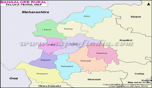
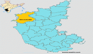
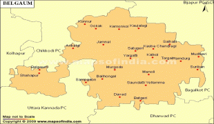
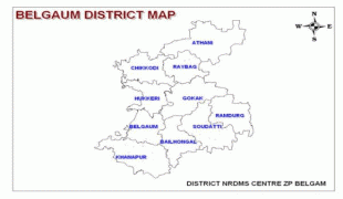
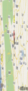
Map - Belgaum
Map


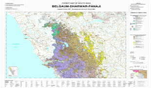
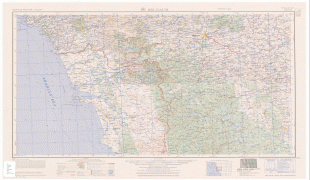


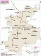
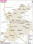


Country - India
 |
 |
| Flag of India | |
Modern humans arrived on the Indian subcontinent from Africa no later than 55,000 years ago. Their long occupation, initially in varying forms of isolation as hunter-gatherers, has made the region highly diverse, second only to Africa in human genetic diversity. Settled life emerged on the subcontinent in the western margins of the Indus river basin 9,000 years ago, evolving gradually into the Indus Valley Civilisation of the third millennium BCE. By, an archaic form of Sanskrit, an Indo-European language, had diffused into India from the northwest. (a) (b) (c), "In Punjab, a dry region with grasslands watered by five rivers (hence ‘panch’ and ‘ab’) draining the western Himalayas, one prehistoric culture left no material remains, but some of its ritual texts were preserved orally over the millennia. The culture is called Aryan, and evidence in its texts indicates that it spread slowly south-east, following the course of the Yamuna and Ganga Rivers. Its elite called itself Arya (pure) and distinguished themselves sharply from others. Aryans led kin groups organized as nomadic horse-herding tribes. Their ritual texts are called Vedas, composed in Sanskrit. Vedic Sanskrit is recorded only in hymns that were part of Vedic rituals to Aryan gods. To be Aryan apparently meant to belong to the elite among pastoral tribes. Texts that record Aryan culture are not precisely datable, but they seem to begin around 1200 BCE with four collections of Vedic hymns (Rg, Sama, Yajur, and Artharva)."
Currency / Language
| ISO | Currency | Symbol | Significant figures |
|---|---|---|---|
| INR | Indian rupee | ₹ | 2 |
| ISO | Language |
|---|---|
| AS | Assamese language |
| BN | Bengali language |
| BH | Bihari languages |
| EN | English language |
| GU | Gujarati language |
| HI | Hindi |
| KN | Kannada language |
| ML | Malayalam language |
| MR | Marathi language |
| OR | Oriya language |
| PA | Panjabi language |
| TA | Tamil language |
| TE | Telugu language |
| UR | Urdu |